
DelDOT webcam shows the view from the top of the Indian River Inlet Bridge south pylon Friday afternoon. (Delaware Department of Transportation)
Hurricane Ian’s remnants will bring a prolonged period of cool, damp and breezy conditions to Delaware into early next week.
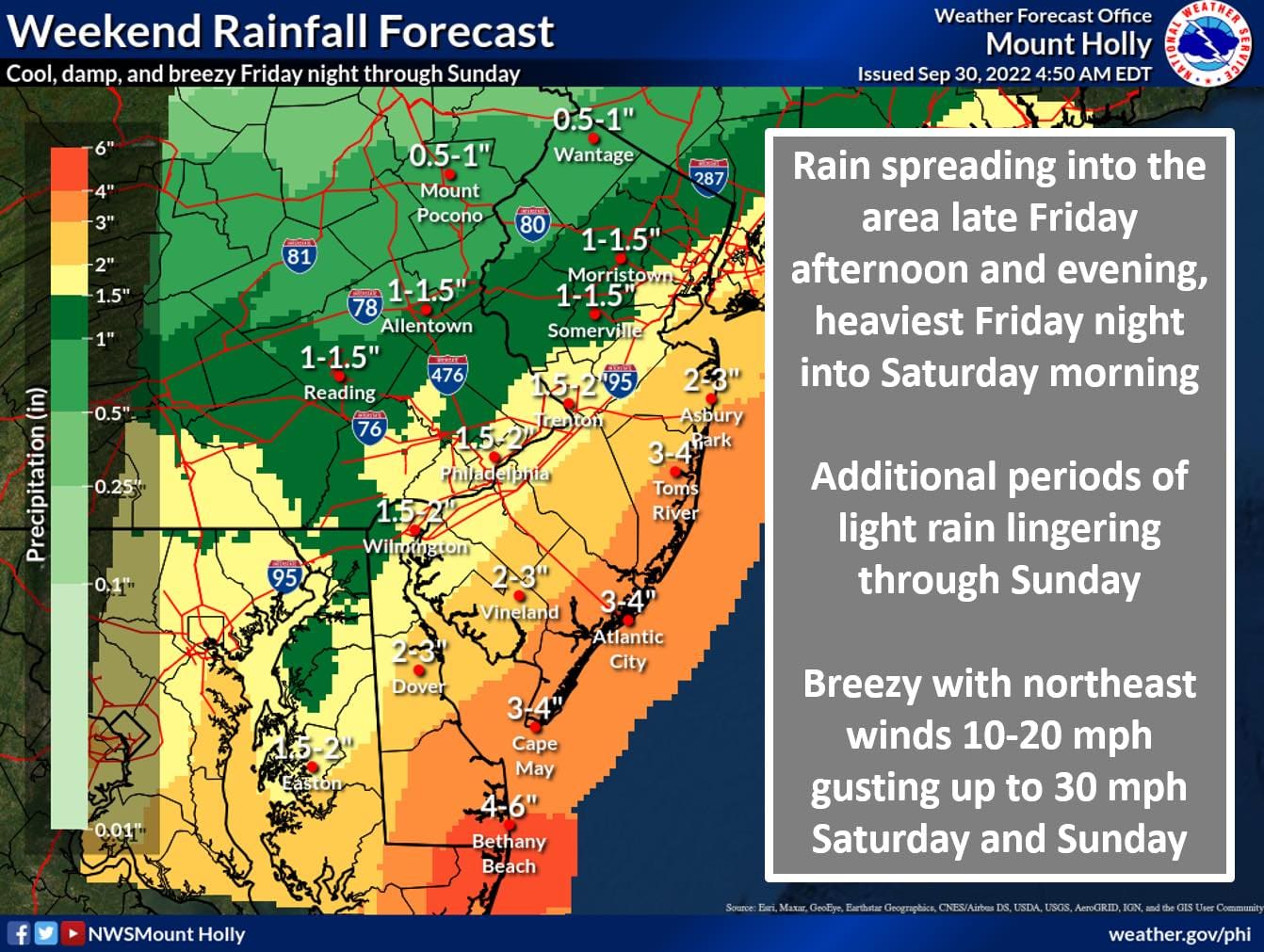
Most of the rain will fall Friday night through Saturday morning, according to the National Weather Service.
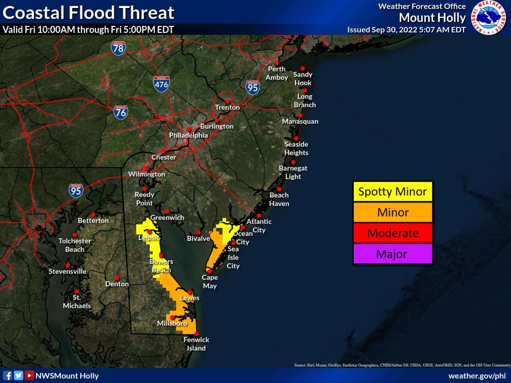
Localized minor tidal flooding is possible Friday night along Delaware’s Atlantic coast and inland bays. Spotty minor flooding is possible during high tide along the Delaware Bayshore.
Bethany Beach will likely see the most rainfall — between four and six inches.
Northeast winds Sunday will increase to 15 to 25 mph with 30 to 40 mph gusts, strongest along the New Jersey and Delaware coasts.
Northeasterly gale force winds are expected for the lower Delaware Bay and the Delaware and southern New Jersey coastal waters Friday night into Saturday morning.
The National Weather Service cautions Delawareans and visitors not to enter the water at the beaches this weekend under any circumstances. There is a high risk of rip currents and substantially-sized waves throughout the weekend.


The city of Milford is offering residents and businesses within city limits free sandbags to protect against potential flooding.
Sandbags are limited to 10 per person and may be picked up at the Public Works warehouse at 180 Vickers Drive in Milford until 3:30 p.m. Friday. To retrieve bags, use the main entrance phone inside the vestibule and somebody will assist you.
Delaware Electric Cooperative said Friday it doesn’t expect widespread outages but scattered outages are possible.
Customers can report outages by calling 855-332-9090 and following the automated system or online at this link.


Share this Post

